SATELLITE COMPASS

Showing all 7 results
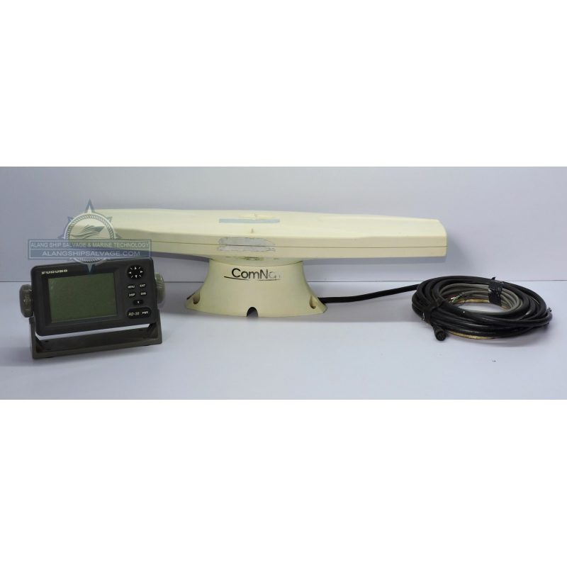
PRODUCT NAME : COMNAV SATELLITE COMPASS ANTENNA WITH FURUNO RD 30 REMOTE DISPLAY COMPANY NAME : COMNAV / FURUNO MODEL NUMBER : RD 30 PRODUCT DESCRIPTION : The ComNav Satellite Compass Antenna combined with the Furuno RD-30 Remote Display creates a powerful system for enhancing navigation and positioning accuracy, often used in marine environments such as commercial shipping, recreational boating, and other maritime operations. This setup typically includes a high-precision Satellite Compass Antenna (which uses GPS or GLONASS satellites) and a remote display (such as the Furuno RD-30), which allows the user to monitor important navigation information in real-time. It provides continuous heading information by utilizing satellite signals to calculate the vessel's heading relative to true north or magnetic north.
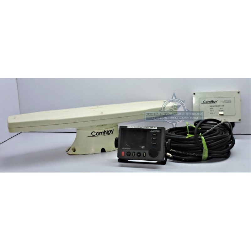
PRODUCT NAME : COMNAV SATELLITE COMPASS MODEL G2 NAVIGATOR COMPANY NAME : COMNAV MODEL NUMBER : G2 NAVIGATOR PRODUCT DESCRIPTION : The ComNav Satellite Compass Model G2 Navigator is a high-precision GNSS (Global Navigation Satellite System) receiver and heading sensor designed for marine navigation. The G2 Navigator is part of ComNav Marine's lineup of satellite-based compass systems that leverage GPS, GLONASS, and sometimes Galileo constellations for delivering highly accurate, real-time position, heading, and velocity data. This device is often used in both commercial and recreational maritime applications where precise navigation, heading, and positioning are crucial. It delivers sub-meter positioning and precise heading data (often down to 0.1° or better), which is critical for accurate route planning, course tracking, and navigation in challenging environments.
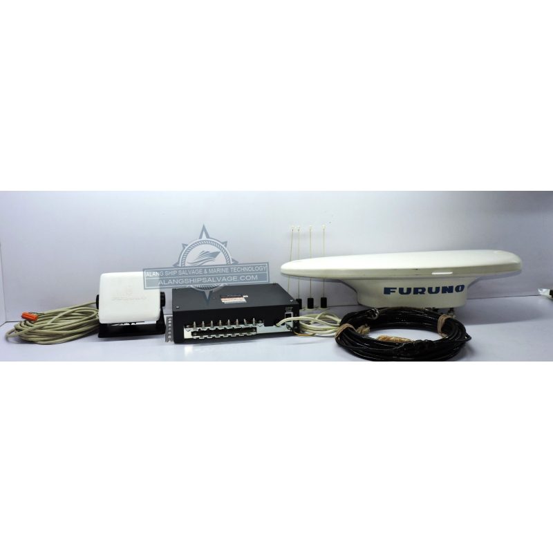
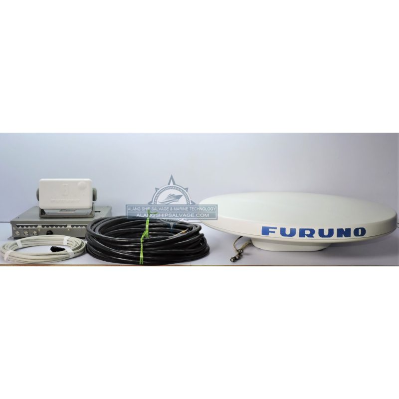
PRODUCT NAME : FURUNO SATELLITE COMOPASS SC-70 SET COMPANY NAME : FURUNO MODEL NUMBER : SC-70 PRODUCT DESCRIPTION : The Furuno Satellite Compass SC-70 Set is a high-precision, integrated navigation system that combines GNSS (Global Navigation Satellite System) technology with advanced heading and positioning capabilities for use in marine environments. It is designed to provide accurate heading, position, and velocity data for a wide range of maritime applications, including commercial shipping, recreational boating, offshore oil and gas operations, and other industries that require precise navigation and real-time data. The dual-frequency capability helps improve position accuracy, reduce ionospheric delay errors, and provides better performance under difficult conditions, such as multipath interference (when signals bounce off nearby structures).
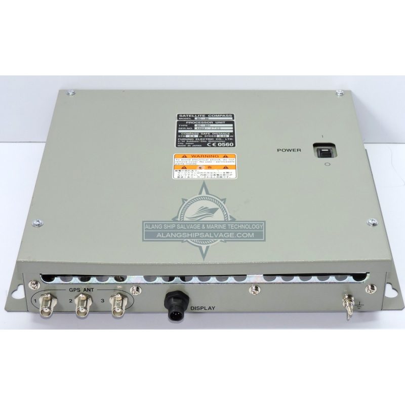
PRODUCT NAME : FURUNO SATELLITE COMPASS SC-50 PROCESSOR UNIT SC-501 NEW COMPANY NAME : FURUNO MODEL NUMBER : SC-501 PRODUCT DESCRIPTION : The Furuno SC-50 Satellite Compass with the SC-501 Processor Unit is a state-of-the-art solution for precise, reliable, and integrated marine navigation. With dual GNSS support (GPS + GLONASS), high-accuracy heading data, and flexible integration with other marine electronics, it replaces traditional systems like gyrocompasses and provides a more modern and efficient alternative. The system's durability, ease of installation, and compatibility with various vessel types make it ideal for both recreational and commercial maritime applications. This solution enhances the safety, efficiency, and accuracy of marine navigation by offering real-time heading, position, and velocity data, crucial for modern maritime operations.
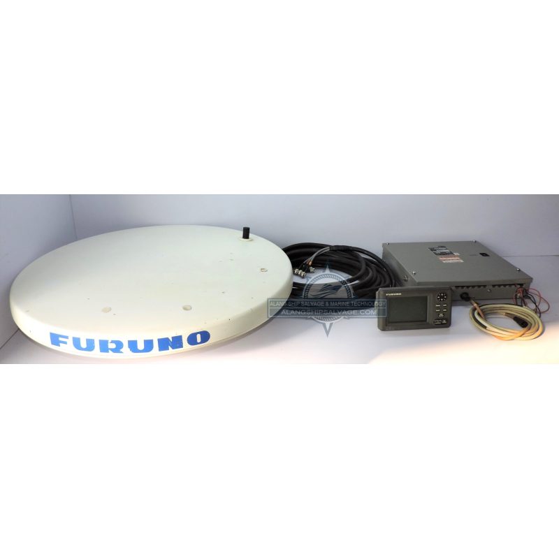
PRODUCT NAME : FURUNO SATELLITE COMPASS SET MODEL SC-50 COMPANY NAME : FURUNO MODEL NUMBER : SC-50 PRODUCT DESCRIPTION : The Furuno SC-50 Satellite Compass Set is a high-precision, marine-grade GNSS-based satellite compass designed to provide accurate heading, positioning, and velocity data for maritime navigation. The SC-50 system is part of Furuno's range of satellite compass solutions and is aimed at improving navigation accuracy and operational efficiency for a variety of vessels, from commercial ships to recreational boats. The SC-50 utilizes dual-frequency GNSS technology (GPS and GLONASS), which improves position accuracy and signal reliability. By using both L1 and L2 frequencies, it reduces ionospheric delay errors and enhances performance in areas with poor satellite visibility (such as near tall structures or under bridges). Positioning accuracy is typically within 1 meter (depending on conditions), which is critical for route planning, collision avoidance, and general navigation.
PRODUCT NAME : FURUNO SC-50 SATELLITE COMPASS COMPANY NAME : FURUNO MODEL NUMBER : SC-50 PRODUCT DESCRIPTION : The Furuno SC-50 Satellite Compass Set is a high-precision, marine-grade GNSS-based satellite compass designed to provide accurate heading, positioning, and velocity data for maritime navigation. The SC-50 system is part of Furuno's range of satellite compass solutions and is aimed at improving navigation accuracy and operational efficiency for a variety of vessels, from commercial ships to recreational boats. The SC-50 utilizes dual-frequency GNSS technology (GPS and GLONASS), which improves position accuracy and signal reliability. By using both L1 and L2 frequencies, it reduces ionospheric delay errors and enhances performance in areas with poor satellite visibility (such as near tall structures or under bridges). Positioning accuracy is typically within 1 meter (depending on conditions), which is critical for route planning, collision avoidance, and general navigation.
PRODUCT NAME : SPERRY MARINE NAVINOT 600S SATELLITE COMPASS COMPANY NAME : SPERRY MODEL NUMBER : NAVINOT 600S PRODUCT DESCRIPTION : The Sperry Marine Navipilot 600S Satellite Compass is a highly accurate and reliable system designed for modern marine navigation. Utilizing dual GNSS systems (GPS and GLONASS) for improved redundancy and signal reliability, it provides precise heading, positioning, and roll/pitch data. The system integrates seamlessly with other onboard electronics like autopilots, radar, AIS, and ECDIS, offering an enhanced navigational experience for both commercial and recreational vessels. With its ease of integration, user-friendly interface, and durability in harsh maritime environments, the Navipilot 600S is ideal for improving navigation safety, route optimization, and overall operational efficiency.